Samoa Volcanoes
-
Savaii
-
Upolu
-
Savaii
-
Savaii
-
Upolu
-
Savaii
Samoa has 2 Holocene volcanoes. Note that as a scientific organization we provide these listings for informational purposes only, with no international legal or policy implications. Volcanoes will be included on this list if they are within the boundaries of a country, on a shared boundary or area, in a remote territory, or within a maritime Exclusive Economic Zone. Bolded volcanoes have erupted within the past 20 years. Suggestions and data updates are always welcome ().
Chronological listing of known Holocene eruptions (confirmed or uncertain) from volcanoes in Samoa. Bolded eruptions indicate continuing activity.
| Volcano Name | Start Date | Stop Date | Certainty | VEI | Evidence |
|---|---|---|---|---|---|
| Savaii | 1905 Aug 4 | 1911 Nov | Confirmed | 2 | Observations: Reported |
| Savaii | 1902 Oct 30 | 1902 Nov 17 ± 4 days | Confirmed | 1 | Observations: Reported |
| Savaii | 1760 | Unknown | Confirmed | 2 | Observations: Reported |
| Savaii | 1610 ± 200 years | Unknown | Confirmed | Isotopic: 14C (calibrated) | |
| Savaii | 1350 ± 50 years | Unknown | Confirmed | Isotopic: 14C (calibrated) | |
| Savaii | 1310 ± 50 years | Unknown | Confirmed | Isotopic: 14C (calibrated) | |
| Savaii | 1240 ± 30 years | Unknown | Confirmed | Isotopic: 14C (calibrated) | |
| Savaii | 1040 ± 150 years | Unknown | Confirmed | Isotopic: 14C (calibrated) | |
| Savaii | 0170 ± 100 years | Unknown | Confirmed | Isotopic: 14C (calibrated) | |
| Savaii | 0480 BCE ± 300 years | Unknown | Confirmed | Isotopic: 14C (calibrated) | |
| Savaii | 1150 BCE ± 150 years | Unknown | Confirmed | Isotopic: 14C (calibrated) | |
| Savaii | 1990 BCE ± 150 years | Unknown | Confirmed | Isotopic: 14C (calibrated) |
Samoa has 0 Pleistocene volcanoes. Note that as a scientific organization we provide these listings for informational purposes only, with no international legal or policy implications. Volcanoes will be included on this list if they are within the boundaries of a country, on a shared boundary or area, in a remote territory, or within a maritime Exclusive Economic Zone. Suggestions and data updates are always welcome ().
There are 6 photos available for volcanoes in Samoa.
 Upolo Island in Samoa is shown in this 8 august 2018 Sentinel-2 satellite image (N is at the top; this image is approximately 70 km across). Younger monogenetic cones and craters that produced lava flows are aligned along the WNW-ESE central ridge, with some lava flows having reached the coast.
Satellite image courtesy of Copernicus Sentinel Data, 2019.
 The 75-km-long island of Savai'i, the largest and highest of the Samoan islands, is a low-angle shield volcano. Numerous scoria cones dot the broad low-profile crest. The unvegetated lava flows in the foreground were emplaced during the most recent eruption in 1905.
Photo by Karoly Nemeth (Massey University).
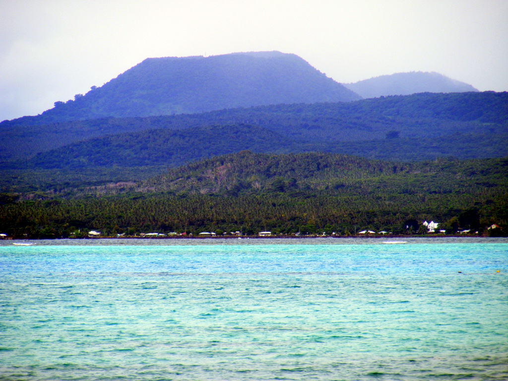
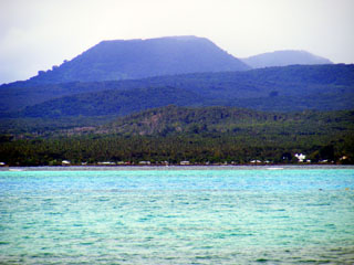 The forested scoria cone of Tafua Upolu rises near the western tip of 75-km-long Upolu Island in Samoa. The shield volcano is elongated in an E-W direction and was constructed during two periods of extensive eruptions during the Pliocene and Pleistocene. Following a lengthy period of erosion, the latest lava flows, at least three of which were estimated to be as young as a few hundred to a few thousand years old, were erupted from vents near the crest of the island at its center and western side.
Photo by Karoly Nemeth (Massey University).
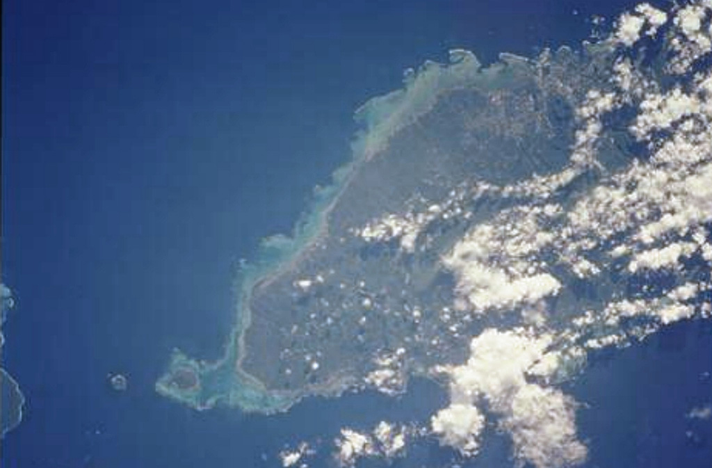
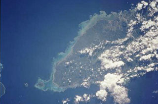 The massive, basaltic shield volcano forming 75-km-long Upolu Island in Samoa is seen in this Space Shuttle view (with north to the upper left). The youngest lava flows, erupted after a lengthy period of erosion, originated from vents near the crest of the island and may be only a few hundred to a few thousand years old. Apolima Island, the small circular island west of reef-bounded Manono Island off the western tip of Upolu (lower right), is a Holocene tuff cone too young to be fringed by a coral reef.
NASA Space Shuttle image STS111-715-29, 2002 (http://eol.jsc.nasa.gov/).
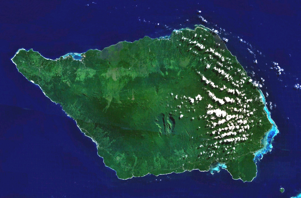
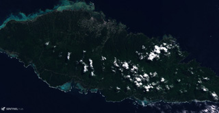
 Savai'i, the largest and highest of the Samoan islands, is shown in this NASA Landsat image (N is to the top). The 75-km-long island consists of a shield volcano constructed along a WNW-ESE-trending rift zone that splits into two rifts on the E side of the island. The broad crest contains numerous scoria cones, some of which were the source of historical eruptions that produced lava flows that reached the sea.
NASA Landsat 7 image (worldwind.arc.nasa.gov)
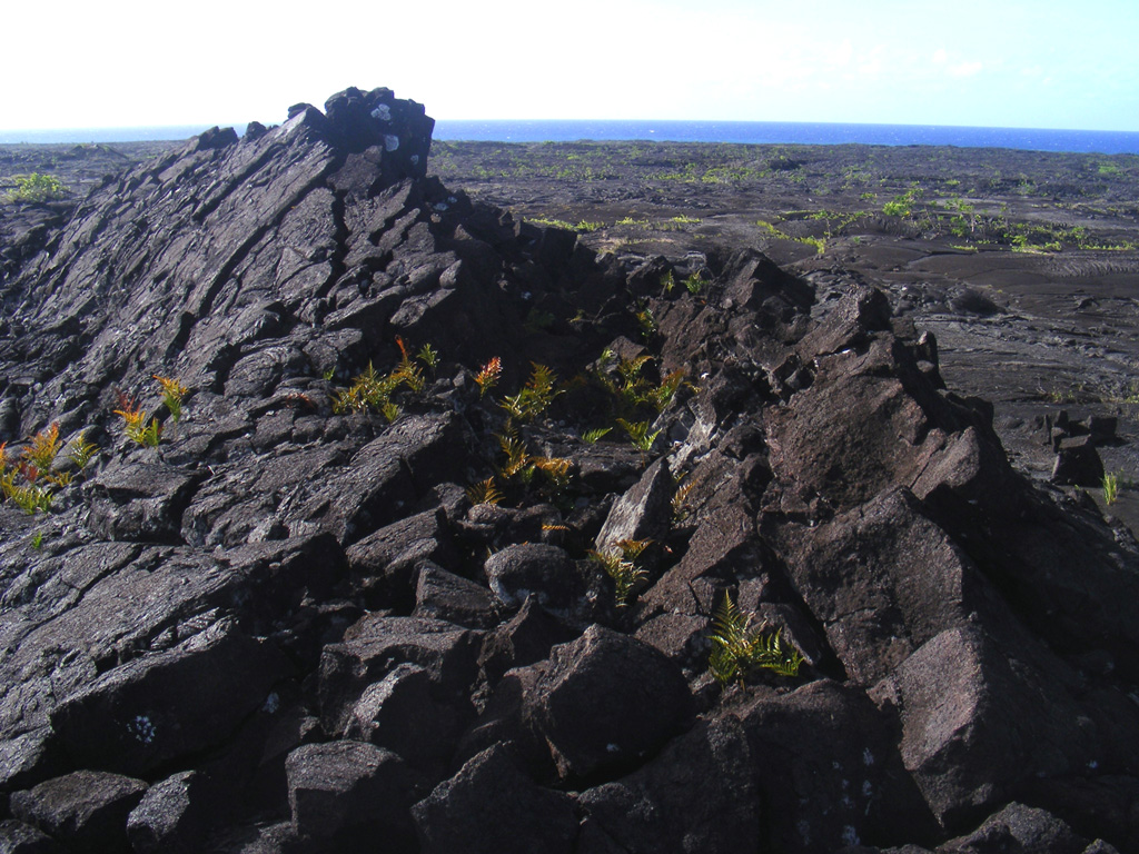
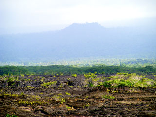
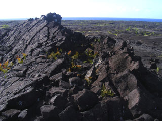 A major eruption of Savai'i took place from 4 August to November 1905. Voluminous lava flows from the Matavanu vent on the N flank flowed 12 km to sea, destroying several villages and many fields. This image shows a pressure ridge on the lava flow, with the N coast in the background.
Photo by Karoly Nemeth (Massey University).
This is a compilation of Samoa volcano information sources, such as official monitoring or other government agencies.
| Volcanic Ash Advisory Center | |
|---|---|
| Wellington Volcanic Ash Advisory Center (VAAC) | |
| - Wellington VAAC Notices | |